Site Assessment
Topographical surveys, site suitability assessments, effluent treatment system design, aerial photography and digital terrain modelling..
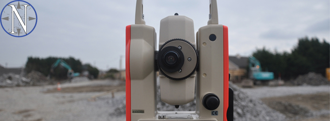
Site Surveying, Analysis and Set-Out
We offer the following services to our clients:
- Percolation Tests
- EPA Site Assessments
- Tier 2 Hydrogeological Assessments
- Natura 2000 Impact Statements
- Topological and GPS Surveys
- Setting Out
- Aerial/Drone Mapping
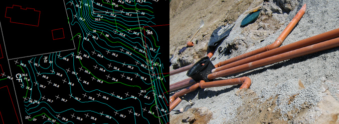
Prior to the commencement of any construction project a thorough assessment of the site is essential. Each site, be it green-field, brown-field, or one with existing development, possesses a unique set of characteristics that will guide and inform the design process. Assessing the characteristics of the site allows the project design to meet the challenges of the site whilst providing a sensitive, effective development. A detailed site investigation will highlight characteristics such as the soil and rock conditions, the surface and groundwater conditions, the architectural vernacular and the site setting in a wider visual amenity context. Armed with the knowledge gained by an appropriate site assessment our firm can design efficient, bespoke developments that suit the prevailing site conditions. The design of effluent systems, surface water drainage, foundations and structures are all dependant on good quality data from a site assessment.
Patrick J. Newell Consulting Engineers provide a wide range of site assessment services including topographical surveys, trial pits, percolation tests, flora and fauna surveys, soil classification tests and where necessary we procure and supervise bore hole and tracer tests. Our team have the expertise and qualifications to carry out Percolation Tests and EPA Site Assessment tests for on-site effluent treatment, Tier 2 Hydrogeological Assessments for large scale on-site effluent treatment, Natura 2000 impact statements, Environmental Impact Statements and a full range of topographical surveys from total station surveys to small scale level and offset surveys.
Our complimentary setting-out skills allow us to accurately position services and structures on site during construction stages. This ranges from the positioning of dwelling houses on site, to complex foundation/holding down bolt settings out, to the setting out of column and beam locations for large scale framed structures.
Modern Aerial Surveying
We utilise drone technology to provide aerial photography, mapping, 3d models and digital terrain modelling.